Yamuna River Levels Rise Gradually After Hathnikund Barrage Releases Water
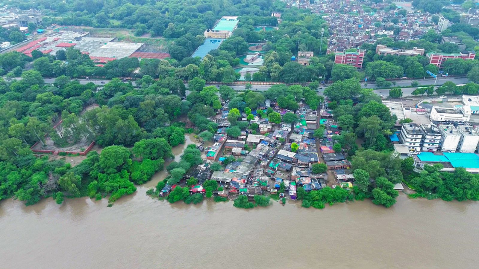
The Central Water Commission (CWC) has reported a gradual rise in the Yamuna river's water level in Delhi following varying water releases from the Hathnikund Barrage over the past two days. Monitoring stations between the barrage and the capital have recorded staggered increases, with the CWC forecasting a steady rise over the next 48 hours.
Data from the CWC shows that water discharge from the Hathnikund Barrage fluctuated significantly, rising from 2,149 cusecs at 6 am on Tuesday to a peak of 24,576 cusecs at 6 pm, before dropping later that night. Another spike to 24,478 cusecs occurred at 2 am on Wednesday, followed by a decline to 8,119 cusecs by 11 am.
Bhim Singh Rawat, a member of the South Asia Network on Dams, Rivers and People (SANDRP), attributed the fluctuations to rainfall in the upper Yamuna catchment area upstream of the barrage. He noted that the impact of these releases typically reaches Delhi after about 48 hours.
This rainfall comes amid a largely subdued monsoon in Haryana. The India Meteorological Department (IMD) reported that Yamunanagar, where the barrage is located, received 274.2 mm of rain against the usual 303.1 mm. Other districts like Panchkula, Ambala, and Karnal also recorded deficit rainfall, while Chandigarh had above-normal precipitation, indicating uneven rainfall across the upper Yamuna basin.
Between Hathnikund and Delhi, the first cluster of CWC monitoring stations includes Western Yamuna Canal, Fatehgarh, Panchkuan, Ghodopipli, and Kala Naur. Among these, Panchkuan and Ghodopipli are flowing above their warning levels. Downstream, stations at Karnal, Mawi Palla, and the Delhi Railway Bridge continue to flow normally, though the CWC has forecast a gradual rise over the next two days.
The CWC predicts that the Yamuna at the Delhi Railway Bridge will rise from 202.2 metres on Wednesday to 202.4 metres by July 31. This remains well below the warning level of 204.5 metres, the danger mark of 205.33 metres, and the highest flood level of 208.66 metres recorded during the severe floods of 2023. The current water discharges from Hathnikund are significantly lower than those during the 2023 floods, which saw exceptionally heavy rainfall across the upper Yamuna basin.
Rawat highlighted a gap in data after Hathnikund, noting that there is no discharge data for the river downstream of the barrage, making it difficult to track flow changes before the water reaches Delhi.
Meanwhile, the Hindon river remains marginally above its warning level of 195 metres but below the danger mark of 196 metres. The CWC forecasts that water levels in the Hindon will stay elevated over the next two days. Earlier this month, a rising Hindon had inundated low-lying settlements in parts of Ghaziabad and Gautam Buddha Nagar, prompting the Uttar Pradesh Irrigation Department to step up monitoring while noting that the river remained below the danger level. Unlike the Yamuna, whose flows into Delhi are influenced by releases from the Hathnikund Barrage, the Hindon is a separate, rain-fed tributary with its own catchment. Originating in the lower Shivalik ranges in Saharanpur district of Uttar Pradesh, it flows through western Uttar Pradesh before joining the Yamuna downstream of Delhi near Greater Noida.