Indonesia Earthquake: 7.7 Magnitude Tremor Kills at Least 40, Triggers Brief Tsunami Alert
A powerful 7.7-magnitude earthquake struck off the coast of Flores island in Indonesia early Saturday, claiming at least 40 lives and damaging buildings and homes, according to officials and witnesses.
The quake, which occurred at a depth of 10 kilometres, struck at 5:58 am local time. The United States Geological Survey (USGS) placed the epicentre approximately 68 kilometres north-northwest of the city of Ende in East Nusa Tenggara province. The tremor prompted a temporary tsunami warning, which was later lifted.
Social media videos and local reports showed collapsed structures and scenes of panic, but authorities have urged caution regarding unverified footage. A resident in Nagekeo district told the AFP news agency that he was at a market when the shaking began. “The shaking was strong. Thankfully, we were already outside the house,” he said, adding that people were “panicking, running here and there” and moving towards higher ground. He confirmed that his family was safe.
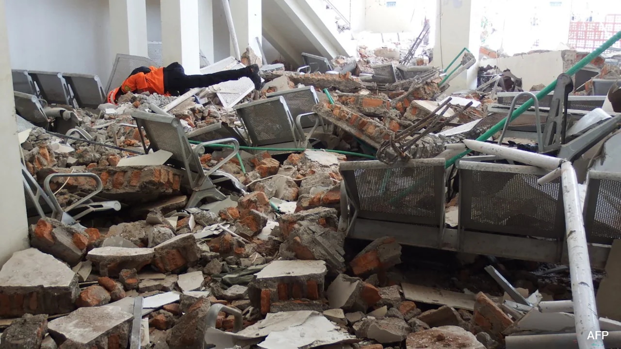
A 31-year-old hospital customer service official described the moment the quake hit. “I panicked when it suddenly started to shake. Patients also fled the hospital; the jolt was big. I saw some walls were cracked,” he said. In Sikka regency, a resident reported significant damage to buildings. “Many buildings here were damaged... I saw that the waiting room at the port terminal in Maumere had collapsed,” she told the AP news agency.
Indonesia’s Meteorology, Climatology, and Geophysics Agency (BMKG) initially issued a tsunami warning and urged residents in coastal areas to evacuate immediately. “We strongly urge our communities along the northern coast of Flores and in the southern parts, on the southern islands and across the southern region, to carry out self-evacuation immediately,” said Abdul Muhari, an official at the national disaster agency, BNPB. He advised residents to move at least two kilometres inland or to higher ground over 10 metres above sea level. The warning was later withdrawn after monitoring indicated no significant tsunami threat.
The disaster follows a history of seismic activity in the region. In 1992, a magnitude 7 earthquake generated a tsunami that killed approximately 2,500 people on Flores island. More recently, a devastating 9.1-magnitude earthquake in 2004 off Sumatra triggered a tsunami that killed around 220,000 people across the Indian Ocean region, including nearly 170,000 in Indonesia. In 2018, a series of earthquakes on Lombok island and nearby Sumbawa killed over 550 people.
Indonesia is particularly susceptible to earthquakes due to its location on the Pacific “Ring of Fire”, an arc of intense seismic activity that runs from Japan through Southeast Asia and across the Pacific basin. The archipelago consists of more than 17,000 islands, many of which lie on active fault lines. The country has been working to improve disaster preparedness, but the frequency and intensity of tectonic movements continue to pose significant challenges.
Local disaster management teams have been deployed to assess damage and assist affected communities. The death toll may rise as search and rescue operations continue in affected areas. Officials have urged residents to remain vigilant for aftershocks and to rely on official communications for safety instructions.