Satellite Images Show Europe's Scorched Land After Summer Heatwaves
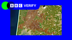
New satellite images have laid bare the severe impact of this summer's extreme temperatures across western Europe. Analysed by BBC Verify, the images reveal widespread damage caused by successive heatwaves that have gripped the region since May.
The visual evidence is stark: shrunken glaciers in the Alps, vast stretches of land scorched by wildfires, once-green fields transformed into arid brown expanses, and rivers reduced to thin ribbons. These images offer a bird's-eye view of a landscape under profound stress.
Even iconic landmarks have not been spared. The Palace of Versailles, located south of Paris, now appears as an island of trees surrounded by brown, parched fields in satellite imagery. The contrast between the palace's manicured gardens and the desiccated countryside highlights the severity of the drought.
The heatwaves have been relentless. France, Spain, Portugal, and other western European nations have experienced record-breaking temperatures, with several locations exceeding 40 degrees Celsius. Wildfires have consumed tens of thousands of hectares of forest, forcing mass evacuations and destroying property.
Agricultural sectors across the region are struggling. Crops such as maize, sunflowers, and grapes have suffered from heat stress and water scarcity. Farmers in France have described the situation as a crisis, with harvests expected to fall significantly below average. The dry conditions have also heightened the risk of fires in rural areas, as dry vegetation becomes highly flammable.
Water resources are under immense pressure. Rivers such as the Loire, Rhine, and Danube have recorded critically low levels, disrupting shipping traffic and threatening drinking water supplies. France has had to truck water to some villages, while Spain's reservoirs have dipped to historic lows. The low water levels also expose previously submerged archaeological artifacts and unexploded ordnance, adding to the complexity of the situation.
Glaciers in the Alps are retreating at an alarming rate. Scientists have noted that this year's melt season has been exceptionally intense, with some glaciers losing several feet of ice depth. This not only affects the region's landscape but also the future availability of water for rivers that originate in the mountains.
The frequency and intensity of these heatwaves are consistent with patterns predicted by climate scientists. According to the Intergovernmental Panel on Climate Change (IPCC), human-induced global warming has increased the likelihood of such extreme events. European scientists have attributed the current heatwaves largely to climate change, although they caution that individual weather events require detailed analysis.
The satellite images serve not only as a record of damage but also as a warning. They provide undeniable evidence that the continent's ecosystems and infrastructure are vulnerable to a changing climate. Governments across Europe are now facing urgent questions about adaptation and mitigation. France has activated drought crisis units, while Spain has put in place emergency measures for municipalities.
The situation is a stark reminder that climate change does not respect borders. The images from space show a continent in distress, and they call for a coordinated response. As the summer continues, the heatwaves are not yet over, and the full extent of the damage may not be known for months.
For now, the photographs from orbit offer a sobering perspective. They show a Europe that appears parched and vulnerable, as if the very land itself is struggling to breathe. The long-term consequences for agriculture, biodiversity, and human health are yet to be fully understood, but the immediate signs are deeply concerning.