Assam Floods: Deforestation and Weak Embankments Turn Rain into Recurring Disaster
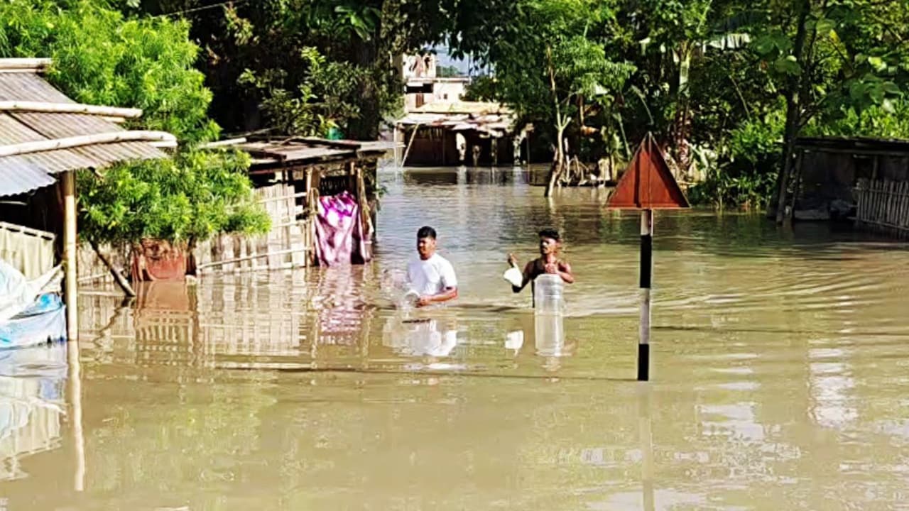
Over the past few days, visuals from Assam have captured the devastating impact of the floods, with villages inundated, roads submerged, and people struggling to rebuild. According to the Assam State Disaster Management Authority, 5.24 lakh people across five districts have been affected.
The floods have impacted Sivasagar, Golaghat, Charaideo, Jorhat, Nagaon, and Kamrup (Metropolitan). The death toll stands at 68. Multiple agencies, including the National Disaster Response Force, State Disaster Response Force, and civil defence personnel, are carrying out rescue and relief operations, with 67 boats deployed in affected areas.
As of the latest reports, 37,139.52 hectares of cropland remain submerged, and 26,679 animals have been washed away. Damage to houses, roads, and other infrastructure has been reported from various affected districts.
Each monsoon, the Brahmaputra valley transforms into a vast expanse of water. While the popular narrative often frames these events as purely natural disasters, environmentalists and scientists point to human activities as key contributing factors.
Professor Dhrubajyoti Sahariah of the Department of Geography and Director of the Centre for Brahmaputra Studies at Gauhati University explains that the severe floods cannot be understood through rainfall alone. He states: "This year's flood was driven by a complex interaction of natural processes and anthropogenic factors. Intense rainfall in narrow valleys triggered a rapid surge in river water levels, which was further intensified by continuous hill excavation, widespread deforestation, and breaches of embankments. A possible impact of dam water release cannot be ruled out, collectively culminating in a catastrophic disaster." Professor Sahariah describes Assam's flooding crisis as a 'compound disaster' where extreme meteorological events coincide with ecological degradation and infrastructural weaknesses.
Key factors contributing to the recurring disaster include deforestation, weak embankments, and water regulation issues. When forests are cleared and hills are excavated for construction and urban expansion, loose topsoil washes into the river system. This causes heavy siltation in the Brahmaputra's riverbed, reducing its water-carrying capacity and causing rivers to breach their banks even during moderate rain surges.
Assam has long relied on earth embankments as its primary flood defence. However, many of these structures are decades old and poorly maintained. During extreme rainfall events, ageing embankments often breach under pressure, turning rising waters into violent flash floods. Additionally, hydro projects accumulate water; when severe rainfall threatens structural overload, dams are forced to release high volumes, adding to the surge in downstream valleys already struggling under regional rainfall.
Experts suggest shifting from reactive relief operations to proactive water management. Recommendations include dredging and desilting primary river channels to restore historical water capacity while preserving aquatic ecosystems, and transitioning from fragile embankments to reinforced, smart-monitored systems with real-time pressure sensors. Establishing real-time data-sharing systems and coordinating with upstream dam operators for controlled releases well ahead of heavy rainfall events are also crucial. Environmentalists stress the need for proper enforcement of anti-excavation laws on hill slopes and large-scale tree planting to stabilise topsoil and reduce silt runoff.